
SEE MORE. REACH FARTHER. OPERATE SMARTER.
Professional AeroStar Drone Solutions from Ramco Rugged
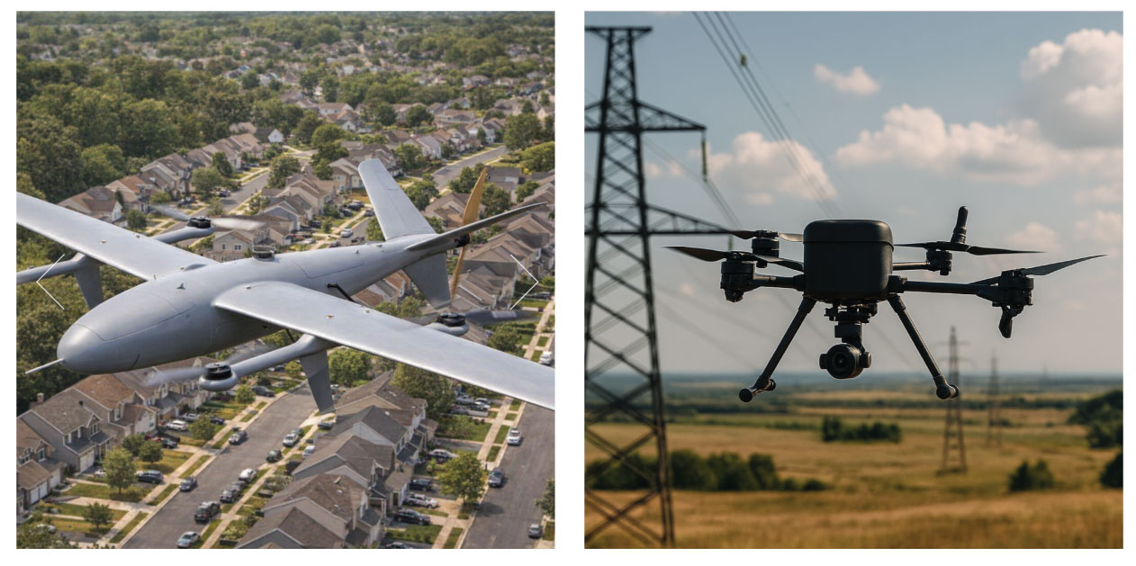
When the work extends beyond what your team can safely or efficiently see from the ground, aerial technology can provide a new perspective.
Ramco Rugged now offers AeroStar Dynamics professional drone platforms designed for inspections, mapping, surveying, situational awareness, data collection, and other demanding field applications.
From targeted inspections requiring specialized imaging to connected autonomous missions, AeroStar gives organizations the flexibility to build an aerial solution around the work they actually need to accomplish.
BRING AERIAL DATA INTO YOUR FIELD WORKFLOW
A drone should do more than capture impressive footage.
For field organizations, the real value comes from getting useful information from places that may be difficult, time-consuming, or inefficient to inspect from the ground.
Depending on the aircraft, payload, and mission configuration, AeroStar platforms can help teams:
Inspect Hard-to-Reach Assets
Capture detailed visual or thermal information from elevated, remote, or difficult-to-access infrastructure while reducing the need to physically approach every inspection point.
Map & Document Large Areas
Capture aerial imagery and location data that can support surveying, site documentation, progress tracking, mapping, and post-flight analysis.
Collect Specialized Data
Configure the aircraft with mission-specific payloads such as high-resolution cameras, thermal imaging, LiDAR, hyperspectral sensors, and other compatible equipment.
Improve Situational Awareness
Use aerial imagery and connected systems to provide operators with another viewpoint during field operations and time-sensitive missions.
Automate Repeatable Missions
Waypoint navigation, mission planning, autonomous flight functions, and data collection capabilities can help make recurring aerial workflows more consistent.
TWO PLATFORMS. DIFFERENT MISSIONS.
AeroStar offers two distinct platforms for organizations with different operational requirements.
AeroStar Enterprise T1
Configure the Aircraft Around the Mission
Some jobs demand precision. Others require thermal imaging, LiDAR, detailed photography, or an entirely different payload.
The AeroStar Enterprise T1 is designed around that flexibility.
At 6.3 kg operating empty weight, the T1 can carry payloads of up to 3 kg. AeroStar lists flight times of up to 50 minutes unloaded and approximately 40 minutes with a full payload, allowing organizations to configure the aircraft around the data they need to collect rather than relying on a single fixed camera system.
Precision Where It Matters
The Enterprise T1 supports:
High-Precision GPS
Accurate positioning for navigation and mission execution.
RTK Positioning
Real-Time Kinematics can provide enhanced positioning accuracy for applications such as precision surveying and mapping.
Autonomous Flight Modes
Create pre-programmed flight routes or use functions such as orbit mode for repeatable inspection workflows.
Optional Terrain Following
Maintain a more consistent flight height as terrain elevation changes.
Optional Obstacle Avoidance
Additional obstacle-avoidance capabilities are available depending on configuration.
ONE AIRCRAFT. MULTIPLE WAYS TO COLLECT DATA.
The T1’s configurable payload architecture allows organizations to select sensors based on the job.
High-Resolution Imaging
Capture detailed visual imagery for inspections, documentation, mapping, or post-flight review.
Thermal Imaging
Identify temperature differences that may help teams evaluate equipment, electrical infrastructure, solar installations, buildings, and other assets.
LiDAR
Capture spatial data for applications requiring detailed measurements, mapping, modeling, or terrain information.
Hyperspectral Imaging
Add specialized imaging capabilities for applications requiring information beyond standard visible-light photography.
AeroStar also lists real-time video streaming, flight-data logging, and optional onboard edge-computing capabilities for applications requiring data processing closer to where it is captured.
THE ENTERPRISE T1 MAY BE A FIT FOR:
Utilities • Infrastructure Inspection • Surveying • Construction • Mapping • Industrial Inspection • Public Safety • Environmental Monitoring
AeroStar VTOL
CONNECTED AERIAL OPERATIONS BUILT AROUND AIRLINK
When the mission requires more than traditional manual drone control, the AeroStar VTOL introduces a different approach.
The all-electric carbon-fiber VTOL aircraft combines vertical takeoff and landing capability with AeroStar’s AIRLink — Artificial Intelligence & Remote Link — flight and mission-control platform.
AIRLink combines the aircraft’s autopilot, AI mission computer, communications, video, and peripheral interfaces into a connected system designed to support more advanced aerial workflows.
MORE THAN A FLIGHT CONTROLLER
Intelligence Onboard
AIRLink incorporates both the flight controller and an AI mission computer, opening the door to onboard processing and automated mission workflows rather than relying exclusively on manual operation.
Built-In Connectivity
Integrated 4G LTE/5G and Wi-Fi connectivity helps support connected operations in the field.
AIRLink also provides interfaces for telemetry, GNSS, Ethernet, CAN, cameras, and additional peripherals, allowing the platform to accommodate different mission requirements.
Integrated FPV Video
A 1080p HDR FPV camera is included within the AIRLink system, with a native CSI interface designed for low-latency video. An HDMI input is also provided for payload-camera connectivity.
Mission Planning & Analytics
AeroStar lists capabilities including:
- 3D cloud-based mission planning
Plan missions before the aircraft leaves the ground.
- Flight management and analytics
Review and manage information associated with aircraft operations.
- Automated workflows
Build greater automation into repeatable missions.
- Onboard artificial intelligence
Bring additional computing capability directly onto the aircraft.
- Real-time situational awareness
Use connected flight data and imagery to help keep operators informed during active missions.
BUILT FOR DIFFERENT OPERATING ENVIRONMENTS
The AeroStar VTOL uses an all-electric propulsion system, a carbon-fiber airframe, and a 2,500 mm wingspan.
AeroStar specifies an operating temperature range of -20°C to +45°C and wind-resistance ratings of 13 m/s in forward flight and 7 m/s during VTOL operation.
Its combination of vertical takeoff and landing, connected flight control, flexible sensor support, and mission-computing capabilities makes the platform worth considering for operations where connectivity and automation are central to the mission.
THE AEROSTAR VTOL MAY BE A FIT FOR:
Infrastructure Monitoring • Public Safety • Large-Site Operations • Remote Data Collection • Mapping • Surveying • Industrial Applications • Situational Awareness
WHICH AEROSTAR PLATFORM FITS YOUR MISSION?
| Enterprise T1 | AeroStar VTOL | |
| Platform | Four-axis multirotor | VTOL aircraft |
| Primary Strength | Configurable precision data collection | Connected and automated aerial operations |
| Payload | Up to 3 kg | Multiple sensor and payload types supported* |
| Positioning | High-precision GPS + RTK | GNSS + AIRLink flight control |
| Mission Planning | Waypoints, pre-programmed routes & orbit mode | 3D cloud mission planning |
| Imaging | High-resolution, thermal, LiDAR, hyperspectral & other options | FPV + configurable mission payloads |
| Connectivity | Real-time video and data capabilities | 4G/5G, Wi-Fi, Ethernet & telemetry |
| Onboard Computing | Optional edge computing | AI mission computer |
| Best Suited For | Detailed inspection, mapping, surveying and specialized data capture | Connected, automated and broader aerial workflows |
FROM THE AIR TO THE FIELD
Build a Complete Field Technology Solution
Adding a drone doesn’t mean the rest of your field technology operates separately.
Ramco Rugged already helps organizations equip teams with rugged laptops and tablets, vehicle docks and mounts, mobile connectivity, printers, scanning solutions, and other equipment designed for work outside the traditional office.
Now, we can help customers add professional aerial technology to that broader field-equipment strategy.
Whether information is being captured from a drone, reviewed on a rugged tablet, accessed from a vehicle, or brought back to a command environment, Ramco can help you evaluate the equipment your teams need to support the workflow.
BUILT AROUND YOUR APPLICATION
No two organizations need exactly the same drone configuration.
The right aircraft can depend on:
- What are you trying to capture?
Visual imagery, thermal data, LiDAR, mapping data, live video, or something more specialized?
- Where will you be operating?
A construction site, utility corridor, industrial facility, emergency scene, remote location, or large outdoor area?
- How precise does the data need to be?
Standard aerial imagery and precision surveying can require very different configurations.
- Who needs access to the information?
A pilot in the field, an inspection team, an operations center, or multiple users?
- What equipment needs to travel with the aircraft?
Your complete deployment may extend beyond the drone itself.
AeroStar platforms are customizable, and AeroStar states that its engineering and software teams can support aircraft customization around specific mission requirements. The company engineers and manufactures its drone platforms in the United States using globally sourced components.
NOT SURE WHERE TO START?
Tell Us the Mission. We’ll Help You Evaluate the Technology.
You don’t need to know which camera, sensor, aircraft, or configuration you need before contacting us.
Tell the Ramco Rugged team what you’re trying to accomplish, and we’ll help you evaluate the AeroStar options available for your application.
Leave a Reply